
Washington DC Weather Warning – Rain, Gusts, and Lightning on the Way
The nation’s capital is bracing for a stormy midweek stretch as a powerful weather system pushes through the Mid-Atlantic. The National Weather Service (NWS) has issued a Washington DC weather warning for heavy rain, strong winds, and possible thunder through Thursday morning.
Residents across the District, Northern Virginia, and Maryland suburbs are urged to prepare for localized flooding, gusty winds, and morning commute disruptions. While this isn’t a tropical storm or hurricane, the system has enough energy and moisture to create conditions that resemble one.
So, what exactly is coming — and how should you prepare? Let’s break it down.
The Storm Setup: What’s Happening in the Atmosphere
Meteorologists describe this system as a classic fall frontal storm — a combination of warm, humid air from the south meeting colder air sliding down from the Great Lakes. When these two collide, the result is intense rainfall bands and embedded thunderstorms.
According to NWS Sterling, VA, the heaviest rain will occur late Wednesday evening into early Thursday, with rainfall totals between 2 to 4 inches, and localized pockets possibly exceeding 5 inches.
Strong southerly winds will gust 35 to 45 mph, especially near the Potomac River and higher elevations. Those gusts could knock down small tree limbs, cause brief power outages, and make travel hazardous on bridges and overpasses.
More from Blogs: Hurricane Melissa 2025 Tracker: Your Real-Time Path & Impact Guide
Timeline: When and Where the Worst Weather Will Hit
| Time (EST) | Expected Conditions | Impact Level |
|---|---|---|
| Wednesday 4 PM – 8 PM | Light rain begins, increasing clouds | Low |
| Wednesday 9 PM – 2 AM | Heavy downpours, isolated thunder | High |
| Thursday 2 AM – 7 AM | Strongest winds, flash flooding risk | High |
| Thursday 8 AM – Noon | Showers taper off, gusts persist | Moderate |
| Thursday Afternoon | Clearing skies, cooler air moves in | Low |
The peak intensity will likely occur overnight Wednesday into early Thursday, coinciding with the morning rush hour.
Low-lying areas such as Rock Creek Park, Georgetown waterfront, Alexandria Old Town, and Southeast DC neighborhoods are especially vulnerable to flooding.
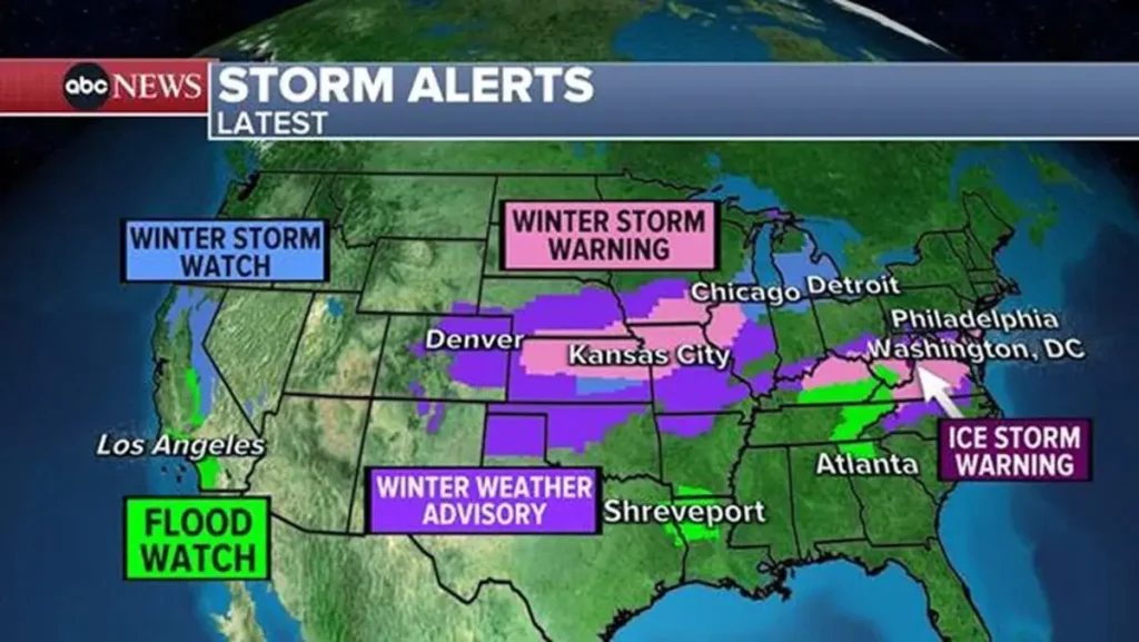
Local Alerts and Warnings
As of Wednesday afternoon:
- Flood Watch: In effect for the entire DC Metro region.
- Wind Advisory: Active until Thursday 10 AM.
- Thunderstorm Risk: Slight to moderate chance, mainly overnight.
The NWS urges residents to avoid travel during heavy rainfall, never drive through flooded roadways, and secure outdoor furniture or decorations before winds intensify.
“This system may not be tropical, but it carries tropical-level moisture,” said meteorologist Andrew Snyder from the NWS Sterling office. “Residents should treat this as a serious rainfall event.”
(Source: National Weather Service).
How This Storm Compares to Previous DC Weather Events
Washington DC is no stranger to heavy rain systems — from Hurricane Ida’s remnants in 2021 to June 2023’s flash floods that swamped parts of downtown.
However, meteorologists note that this week’s storm stands out for its long duration and widespread coverage. Unlike a quick summer thunderstorm, this one will linger for nearly 12–18 hours, saturating soil and overwhelming drainage systems.
What to Expect: Impacts Across the DC Metro
1. Flooding and Standing Water
Expect ponding on major routes like I-66, I-395, and the George Washington Parkway. Commuters should allow extra time, especially Thursday morning.
2. Transit Delays
Metro officials have warned of potential slowdowns on outdoor rail segments. Bus routes near flood-prone intersections may also face diversions.
3. Power Outages
With winds reaching 40+ mph, tree branches may fall onto lines, especially in suburban Maryland and Northern Virginia. Have flashlights and phone chargers ready.
4. Flight Disruptions
Reagan National (DCA) and Dulles (IAD) could experience delays or temporary ground stops, particularly late Wednesday night.
Safety Checklist: Preparing for the Storm
Here’s a quick, practical checklist every DC-area household can use:
Secure outdoor furniture, trash bins, and Halloween decorations.
Charge phones, laptops, and power banks.
Keep flashlights and extra batteries accessible.
Check sump pumps and clear gutters
Avoid parking under trees or power lines.
Have non-perishable food and bottled water on hand.
Download the FEMA and NWS apps for live alerts.
If you live in a basement or flood-prone area, move valuables to higher ground and consider sandbags or water barriers as a precaution.
The Role of Climate Change in DC’s Storm Patterns
Scientists have observed a clear trend: storms in the Mid-Atlantic are becoming more intense and wetter.
A 2024 report by NOAA found that Washington DC now sees 20% more heavy rainfall events compared to the 1980s. Warmer air holds more moisture, leading to heavier downpours during frontal systems like this one.
This means that storms once considered “rare” are now appearing multiple times a year, testing the region’s stormwater infrastructure.
Looking Ahead: When Will the Weather Clear?
By Thursday afternoon, drier and cooler air will move in behind the front. Skies should gradually clear, and temperatures will settle in the upper 50s by evening.
Friday looks calmer, with partly sunny skies and highs near 60°F, marking a refreshing change after the storm.
The weekend forecast currently calls for mild, breezy, and mostly dry conditions — a welcome relief for anyone planning outdoor events.
How Local Agencies Are Responding
- DC Water has activated its flood response crews and is monitoring drainage tunnels across the city.
- Pepco has staged extra power restoration teams in anticipation of outages.
- DDOT (District Department of Transportation) has warned residents to report blocked storm drains and avoid underpasses during peak rainfall.
Emergency shelters are also on standby for any localized flooding emergencies.
Comparing This Storm to Others in the Region
| Event | Year | Peak Rainfall | Key Impact |
|---|---|---|---|
| Hurricane Ida Remnants | 2021 | 3.5 in | Flash floods, Metro delays |
| Flash Flood Storm | 2023 | 2.8 in | Major street closures |
| This Week’s Storm | 2025 | Up to 5 in | Extended rain, strong winds |
This comparison shows that while the 2025 storm may not be the most extreme in speed or strength, it’s one of the most prolonged and widespread.
Tips for Commuters
- Leave early Thursday morning. Roads will be slower than usual.
- Use Metro where possible — but check for alerts before leaving.
- Watch for hydroplaning on major roads.
- Work remotely if your job allows.
Safety is far more important than being on time.
What Residents Are Saying
Many locals have already noticed the gusts picking up and the smell of rain in the air.
“I’ve lived here for 12 years, and this feels like one of those nights you just stay home and listen to it pour,” said Erin M., a Georgetown resident. “We’ve had storms before, but the warnings this time seem stronger.”
For many DC residents, this storm is a reminder of the city’s ongoing struggle with aging drainage systems and the reality of heavier rainfall events.
Expert Insight
Meteorologist Lydia Patterson of Weather Channel’s Mid-Atlantic team said:
“The key difference this time is duration. It’s not one burst of thunder and done — this is sustained rainfall for hours. The flooding risk grows with each hour the rain continues.”
(Source: The Weather Channel).
The Bottom Line
This storm won’t go down as a hurricane, but its impact on Washington DC weather could be just as disruptive.
Heavy rain, gusty winds, and thunder will make for a rough night across the region — but preparedness can make all the difference.
By Thursday afternoon, conditions will improve, and the focus will shift to cleanup and recovery. Until then, stay indoors, stay informed, and stay safe.
FAQs
1. What time will the heaviest rain hit DC?
Between 9 PM Wednesday and 7 AM Thursday, according to NWS forecasts.
2. Will schools close due to the storm?
As of now, schools remain open, but check local announcements Thursday morning.
3. Is this storm related to a hurricane?
No. It’s a frontal system, not tropical, though moisture from the Atlantic is enhancing rainfall.
4. How much rain is expected?
2–4 inches for most areas, with isolated totals near 5 inches.
5. When will it clear?
Rain should taper off by Thursday afternoon, followed by cooler and drier air.